Stockbridge: Schaff-Haus Drive
Schaff-Haus Drive is a development of 30 A-frame homes near the Pittsfield town line that belong to a mix of seasonal and part time residents. The houses expirenced severe innundation and erosion damage beacuse they are all built only a few feet from the Tweed River. The homes are all located within the FEMA and FEH flood hazard areas, however, when they were built by developer John Giorgetti in the 1960s setbacks and flood zones did not exist to prevent this hazardous developnent construction. Historically the Lumbar Railroad (shown in the map below) pushed the Tweed against the valley wall
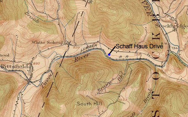
This map from 1917 shows how the Lumbar Railroad streightened the Tweed and pushed it against the valley wall, this increased the power of the river as well as gave people the illusion that development could take place close to the river.
• Damage to roads and bridges including damage to the homes on Schaff Haus Drive are included in the TS Irene Damage tab.
• Information about the watershed is included in the Watershed tab
• Information about the river reaches and the upstream factors that contribute to damage are included in the Stream Assessment tab
Read more about the damage on Schaff Haus Drive in these articles by the Burlington Free Press Hard Lessons of the Tweed.
And in this follow up article Irene Not Over in Stockbrige.